A flurry of measurements associated with the Jefferson Parkway, proposed trail improvements within the Refuge, and eventual changes to link up with the Rocky Mountain Greenway have been carried out since xx. These are discussed in the documents
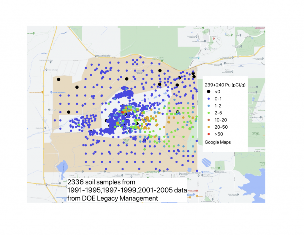
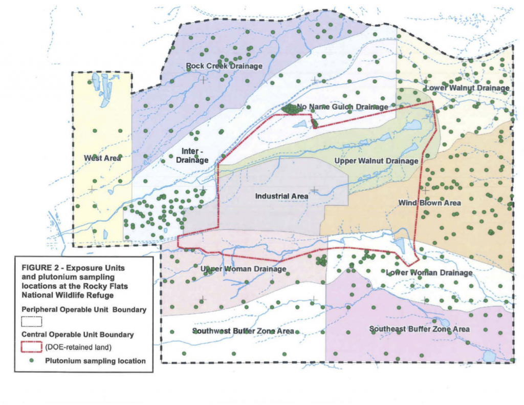
- A great deal of sampling by DOE took place in what is now the Refuge well before the Superfund cleanup and after. Values have been redrawn for clarity.
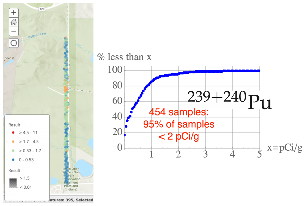
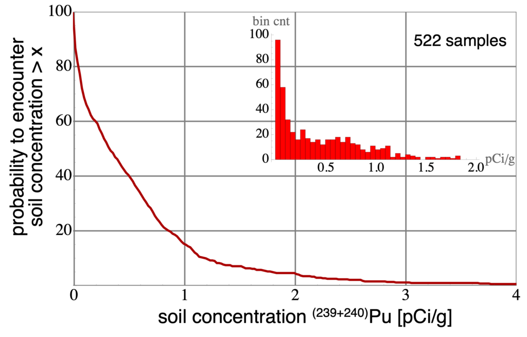
- 454 samples were taken as part of the Jefferson Parkway sampling project along the right-of-way for Indiana Street, where historically the largest Pu soil concentrations occur because of prevailing winds. The plot below shows that about 95% of samples have values below 2 pCi/g.
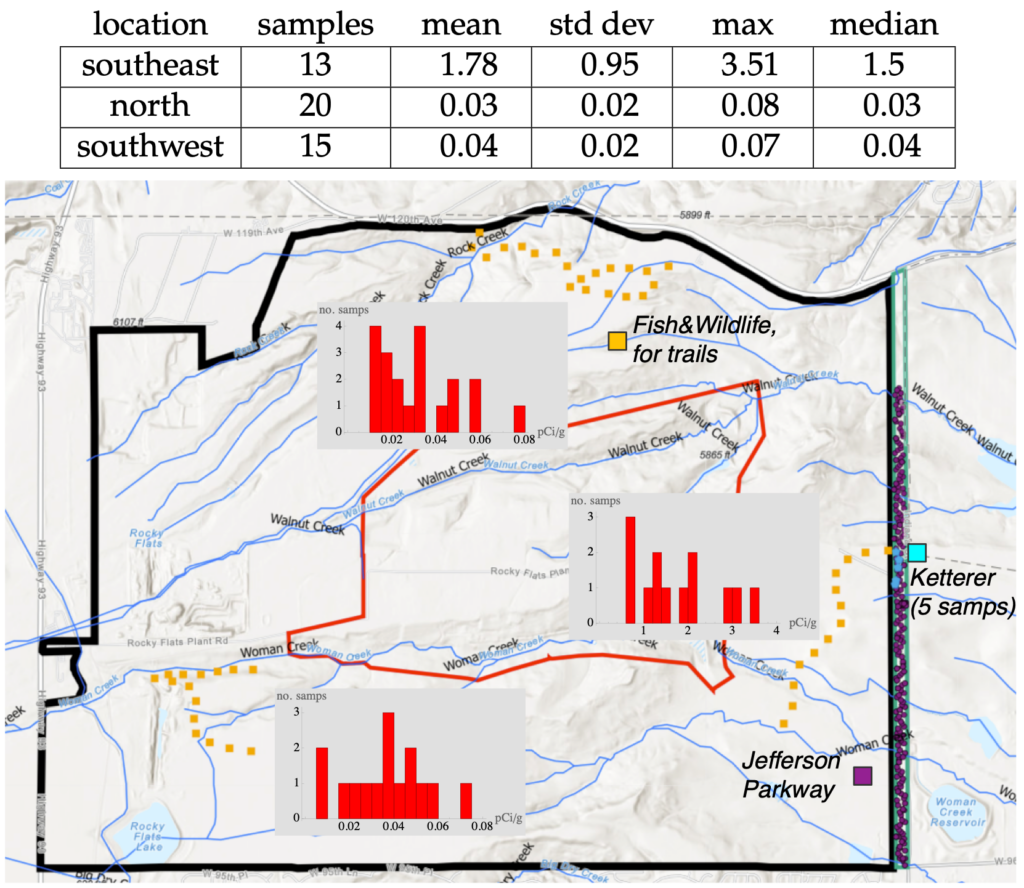
- Additional sampling was carried out by the Fish & Wildlife Service in the runup to trail improvements, as shown as orange squares in the figure with histograms
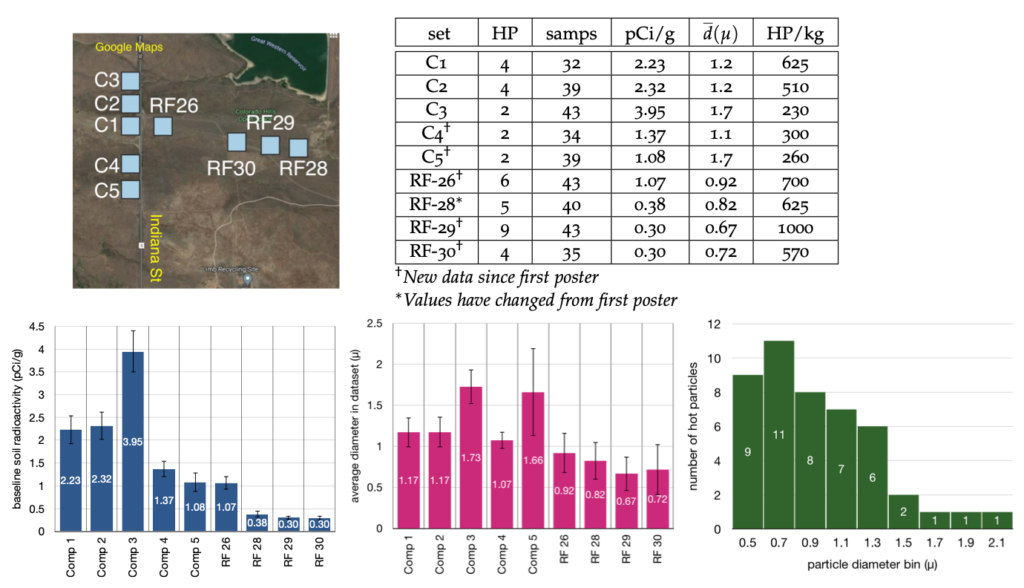
- In 2019, Dr. Michael Ketter searched for "hot particles"in 9 areas, mostly adjacent to the right of way--results are shown below. Given particle sizes and how often they occur it is easy to incorporate this data into total soil Pu concentrations.
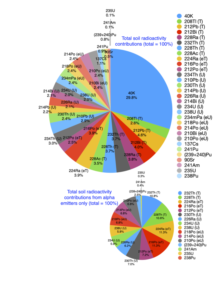
- Merging F&W and Jefferson Parkway sampling (with 522 samples in total) gives a current idea of soil Pu levels. To the extent that these are representative (true really only for Parkway dataset), we can estimate the probability to encounter a given soil Pu level, shown below. There is roughly a 4% chance of encountering regions with more than 2 pCi/g. This should be compared with 53.4 pCi/g for total soil radioactivity.
